Pierce's Disease Control Program Maps
Areawide Trapping
Geographic Information Systems (GIS) is utilized as a decision tool in the Areawide management of glassy-winged sharpshooter (GWSS) in California. Areawide GWSS traps are deployed using GIS/GPS locations, and serviced using a GIS application on iPhones. GWSS trapping data is uploaded to a server, allowing Areawide managers to determine GWSS hotspots and extent in Fresno, Kern, Madera, and Tulare counties. Monthly servicing of Areawide GWSS traps show where the GWSS vectors have been detected on a GIS map Dashboard.
Infested Areas
These are areas subject to program regulations because of the presence of the glassy-winged sharpshooter. There are overviews of current and eradicated infested areas throughout the state, and maps that are designed to clearly show the boundaries of the infested areas for the partially infested counties.
Infested Areas
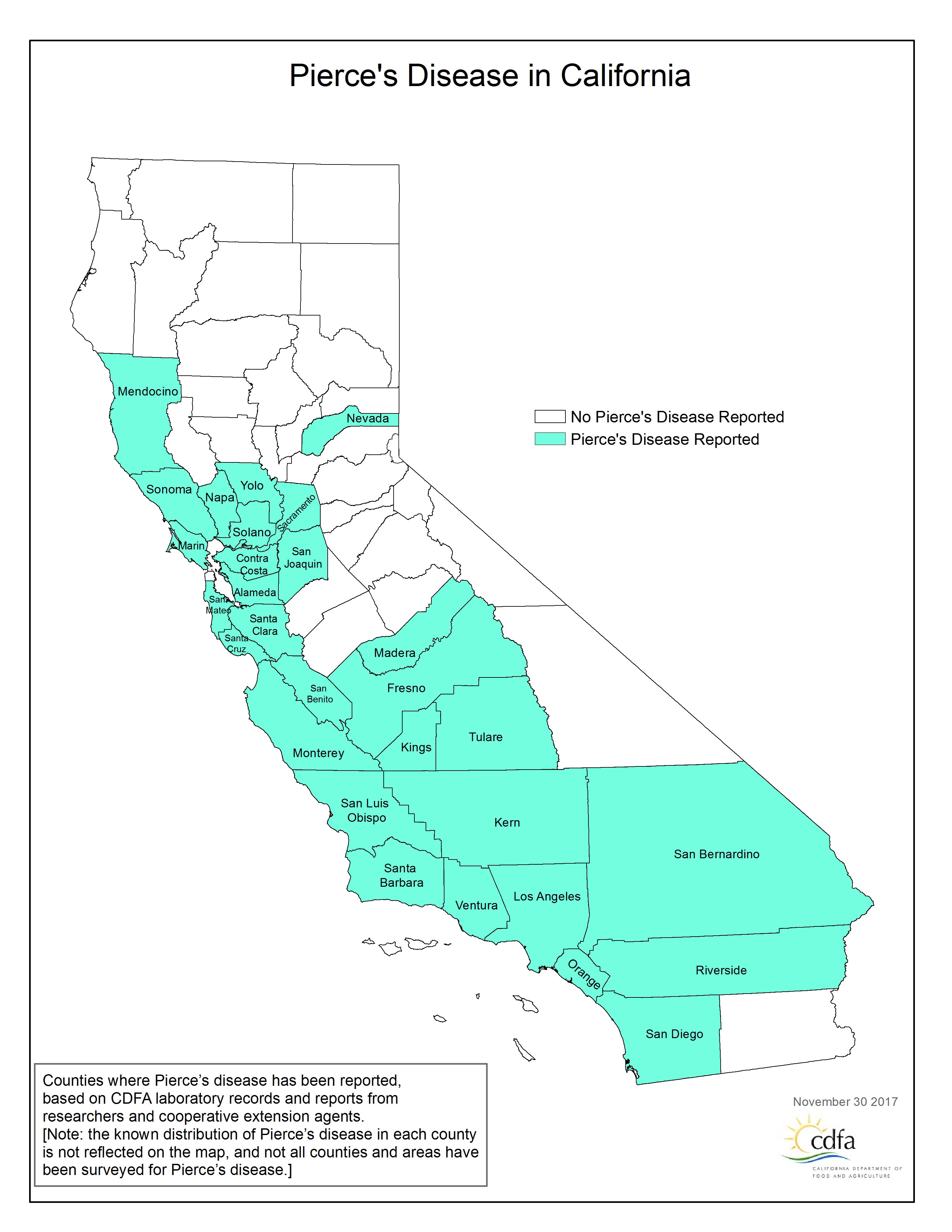
Pierce's Disease Distribution by County
This map is based on finding one or more locations within a county where grapevines are exhibiting the symptoms of Pierce's Disease(PD). The symptoms are associated with the presence of Xylella fastidiosa in the plant. The strain of X. fastidiosa that causes PD may be present in other counties, but if no infected and symptomatic grapevines have been reported to CDFA, then PD will not be reported from that county. Also, indicating that PD is "present" in a county does not indicate how extensive the distribution or damage from PD is in that county.